














 Mean Stack Development
 Vue JS Development
 Javascript Development
 React JS Development
 Angular JS Development
 Next JS development
 Java Development
 Python Development
 Django Development
 Cherrypy Development
 C# Development
 ASP.NET Development
 NodeJS Development
 Laravel Development
 CodeIgniter Development
 Zend Development
 Ruby on Rails Development
 CakePHP Development
 PHP Website Development
 Symfony Development
 Drupal Development
 Joomla Development
 Wordpress Development
 .NET Nuke Development
 Kentico
 Umbraco
 .NET MAUI Development
 Xamarin Application Development
 iOS Application Development
 Android Application Development
 Android Wear App Development
 Ionic Development
 iBeacon Application Development
 Universal Windows Platform (UWP)
 Kotlin Application Development
 Swift Application Development
 Flutter Application Development
 PWA Application Development
 Flutter Health Tech & Wearable App Development Company
 React Native Health Tech Wearable App Development
 Offshore Software Development
 Custom Application Development
 Front-End Development
 Full Stack Development
 AI & Machine Learning
 Custom CRM Solutions
 Flask Software Development
 Electron JS Development
 ChatGPT Development
 Telemedicine App Development
 Build Smart Telemedicine Platform
 Beauty & Salon App Solutions
 Hire Workato Experts
 Magento Development
 Magento 2.0 Development
 Magento Enterprise
 Shopping Cart Development
 Prestashop Development
 Shopify Development
 Open Cart Development
 WooCommerce Development
 BigCommerce Development
 NopCommerce Development
 Virto Commerce Development
 AspDotNetStorefront Development
 .NET Application Development
 Microsoft Dynamics CRM
 VB .NET Development
 Sharepoint Migration
 ASP.NET Core Development
 ASP.NET MVC Development
 AJAX Development
 Agile Development
 Microsoft Bot
 Microsoft Blazor
 Microsoft Azure Cognitive
 HTML 5
 UI/UX Design
 Graphic Design
 Adobe Photoshop
 XML Application Development
 Cloud Computing Solutions
 Azure Cloud App Development
 AWS Development
 Google Cloud Development
 Certified AWS IoT Services Developers
 DevOps Consulting & Development
 Kubernetes Consulting & Services
 SQL Programming Development
 MySQL Development
 MongoDB Development
 Big Data
 Robotic Process Automation
 Social Media Marketing
 Search Engine Optimization
 QA Testing
 Software Testing
 Software Security
 Maintenance And Support
 I.T. Consulting Services
 Business Intelligence
 YII Development
 Data Analysis
 Alexa Skills Development
 On Demand App for Mobile repairing services
 On Demand App for Car Service Booking
 On Demand App for Cleaning Services
 On Demand App for Pharmacy
 On Demand Dedicated Developers
 On Demand Lawyer App Development










 Nuki Smart Lock
 Salto Smart Lock
 TTlock Smart Lock
 NFC App Development
 Custom IOT Enabled Smart Lock
 Smart Locker Solutions
 Hospital Smart Lock Systems
 Hotel Smart Lock Systems
 Smart Home & Office Locks
 Smart Access for Schools & Colleges
 Unloc Smart Lock Integration
 Yale & August Smart Lock Integration
 Populife Smart Lock Integration
 Smart Lock Hardware Development
 Dairy IoT Solutions
 Agri IoT & AI Solutions
 Weather & Climate Solutions
 Water & Waste Management Solutions
 RaspBerry Pi
 Firmware Software Development
 ESP 32 Software Development
 Embedded Development
 Internet of Things
 Smart IoT Development
 IoT Sensor Integration & Development Solutions
 Smart IoT System Development for HVAC
 Tuya IoT App Development
 Particle IoT SDK
 IoT Development with AI
 Smart Pet GPS Tracker
 Dairy GPS Tracking Solutions
 GPS Fleet Management Software
 Car Rental & Subscription Solutions
 Car Buy & Sell Marketplace Development
 AI-Powered Car Wash App Development
 PCB Design & Fabrication
 IoT AC Automation
 AI–IoT Painting Solutions
 IoT Wearable Hardware & App Development
 HVAC Automation & AI Control Systems
 Smart Home IoT Engineering
 AI Embedded Systems
 AI Hardware Design Service
 Advanced IoT Hardware & Firmware Development
 Device Driver Development Services
 NXP i.MX RT Firmware & Hardware Services
 Microchip PIC & AVR Development
 Hire IoT Architects
 IoT Cloud & Infrastructure Solutions
 Infineon XMC / AURIX Development Services
 Matter & Thread IoT Services
 Native IoT Mobile App Development (BLE & Wi-Fi)
 Snapdragon IoT Firmware Development
 Renesas RA/RX Firmware Services
 Silicon Labs EFR32 Development Services
 Smart Wearable App Development
 Smart IoT Meters
 Smart Healthcare Wearable App Development
 Health Care Monitoring System
 Fitness Tracking App Development
 Smart Home Automation Apps
 nRF PCB Design
 ESP32 PCB Design
 Embedded Wearables Engineers
 Rental Property Management System
 Building Management System
 Smart Lighting Development
 Infineon Semiconductor Firmware Development Services
 Custom Camera Development: Hardware, Firmware & PCB Prototyping
 Smart Security Camera SDK
 Nordic Semiconductor SDK
 Infineon SDK
 Arduino SDK
 NFC Lock Integration
 Kerong Lock Integration
 IoT & AI Solutions for Manufacturing
 Smart Inventory & Logistics Solution
 Food & Beverage Industry Solutions
 Smart Hospitality Solutions
 Smart Property Management
 Custom Smart Home IOT SDK
 Smart IoT & AI in Healthcare
 AI-Powered Security Solutions
 Smart Home Safety & AI
 Veterinary Clinic Management (AI)
 Pet Care System (AI & IoT)
 Pet Training & Adoption (AI)
 Healthcare IoT Development
 Event Management Software
 Money Remittance App
 Money Lending App Development
 Utility and Bill Payment App
 IoT Mobile App Development (Flutter & React Native)
 AI & IoT Retail Solutions
 Smart EV App Development
 Smart Solar IoT & AI Solutions
 IoT-Based Energy Systems
 Smart Energy & Utilities Solutions
 6G Solutions
 IoT Security Solutions
 AI-Powered Lottery App Development
 AI-Sports Fitness Club Management
 Travel
 Real Estate
 Medical & Healthcare
 e-Learning
 Consumer Products
 Finance
 Automobile
 Media & Entertainment
 Billing Software
 Enterprise Resource Planning (ERP)
 Augumented & Virtual Reality
 Point of Sale(POS) Development
 Learning Management System
 EV Charging Solutions
 About Us
 Partners & Certifications
 Quality Assurance
 Our Clients & Testimonials
 Development Process
 Our Products
 Social Responsibility
 Work Ethics
 Vision & Mission
 Awards
 Live Project Demos
 Contact Us
 Case Studies
 Portfolio
 Blog
Blog
Bluetooth Direction Finding AoA/AoD & RTLS Development with Nordic nRF
Warehouses lose time searching for tools. Hospitals need to locate shared equipment without calling every ward.
A standard BLE beacon can tell a receiver that an asset is nearby, but signal strength alone struggles to identify its direction in a reflective indoor space. Bluetooth Direction Finding adds angle measurements to the design.
Combined with thoughtfully placed locators and positioning software, those measurements can support an indoor real-time location system (RTLS).
Adequate Infosoft develops the components needed to evaluate and build such systems: Nordic nRF-based tags and locator firmware, antenna-array hardware integration, location services, dashboards, and mobile applications.
We begin with the operational problem, which could be locating a tagged object, recognizing a transition between zones, or leading a person through the building. The required accuracy of location, update rate, and cost of installation will define the architecture.
What is Bluetooth Direction Finding?
Bluetooth Direction Finding is an exciting new technology introduced with Bluetooth 5.1. Bluetooth Direction Finding technology employs a transmitter that transmits a packet containing a continuous tone extension.
A compatible receiver obtains the information by sampling the in-phase and quadrature components of the radio signal while switching antennas in a defined sequence. The phase difference provides information which is practically used by software to estimate the direction.
An angle is a bearing, not a complete position; multiple measurements, known anchor locations, and coordinate calibration are normally needed to place an asset on a floor plan. Nordic Semiconductor's direction-finding overview explains the two operating models.
Angle of Arrival (AoA):
A relatively simple tag transmits the CTE. A fixed locator receives it through an antenna array and estimates the direction of the tag. AoA usually suits asset-tracking deployments with many battery-powered tags and fewer, more capable fixed locators.
Angle of Departure (AoD):
A fixed transmitter switches among antennas as it sends the CTE. A compatible receiving device estimates its bearing to the transmitter. AoD can suit navigation or device-centric positioning when the receiving hardware and software support that role.
Just because a person’s mobile device performs BLE scanning does not imply the device is capable of transmitting I/Q data for AoD, the user’s needs must be confirmed prior to implementing delivery via mobile device.
These processes are not guaranteed to yield precision results to the centimeter level. The final results may be influenced by antenna design and placement, installation height, metal racks, walls, operators’ movement, and multipath effects.
We define acceptance criteria for the actual building, then measure them in a pilot rather than using a laboratory accuracy figure as a product claim.
Nordic nRF hardware and software choices
For a direction-finding design, we evaluate Nordic's nRF52833 and the nRF5340, both listed by Nordic for Bluetooth Direction Finding. The nRF52833 suits compact tags or locators; the dual-core nRF5340 offers processing headroom. Final selection depends on radio role, power, availability, firmware support, and qualification.
Chip-family names alone are insufficient. The popular nRF52840 is useful in many BLE products, but Nordic does not list it as a direction-finding SoC.
An earlier project using an nRF52840 device thus shows transferable work related to BLE products, as opposed to evidence of nRF52840 device support for AoA/AoD. We check the SoC, PCB, SDK version, controller features, and antenna-switch connections before setting up the BOM.
nRF Connect SDK from Nordic and Zephyr direction-finding examples serve as a practical basis for CTE transmission and reception as well as I/Q data collection.
Production firmware requires configuration data storage, diagnosis, secure updates, power management, and a reliable mechanism for transmitting measurements from each beacon to the position service.
The application must also record antenna-switch patterns and calibration versions; changing either without updating the estimator can quietly corrupt angle results.
Relevant Adequate Infosoft project experience
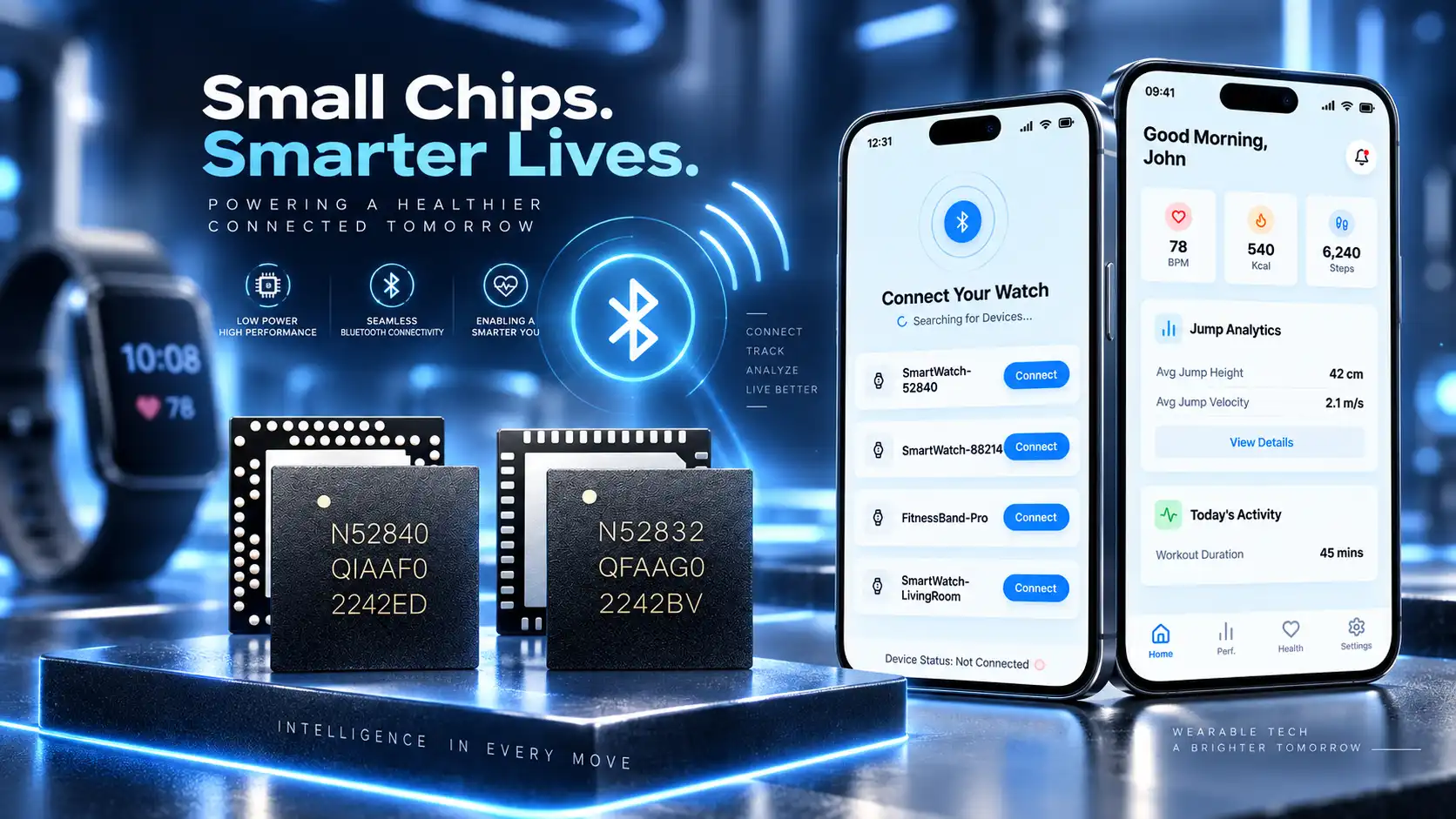
IoT Smart Watch Development with BLE & Mobile App Integration
The nRF52 smartwatch case study that we published includes information about hardware and low-power BLE software as well as health and fitness features and prototypes developed for production purposes.
These are useful fields when it comes to a wearable RTLS device, such as providing power budget estimation. In our case study, it is clarified that Bluetooth Direction Finding is not used by the smartwatch.
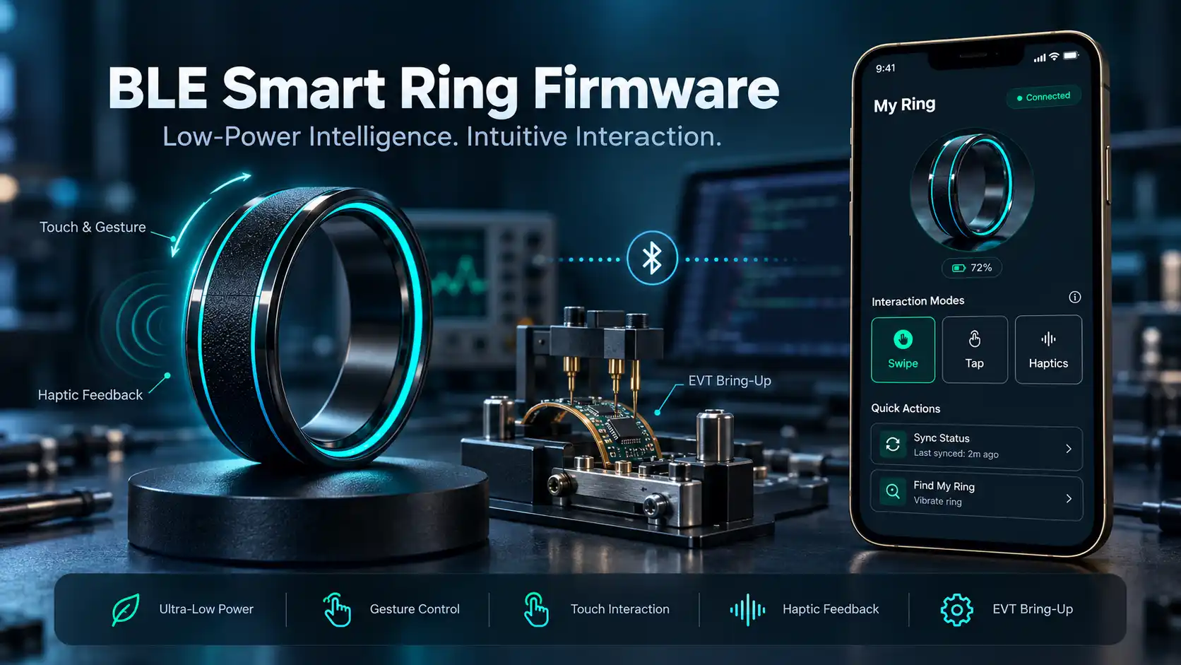
Wearable BLE Smart IoT Ring Development with Nordic nRF52
The Nordic nRF52 BLE smart ring project describes compact-device firmware, gesture interactions, BLE communication, and EVT hardware work.
It illustrates how much enclosure, energy, and firmware architecture matter when a location tag must be small enough for daily use. It is a wearable firmware reference, not a measured AoA pilot.
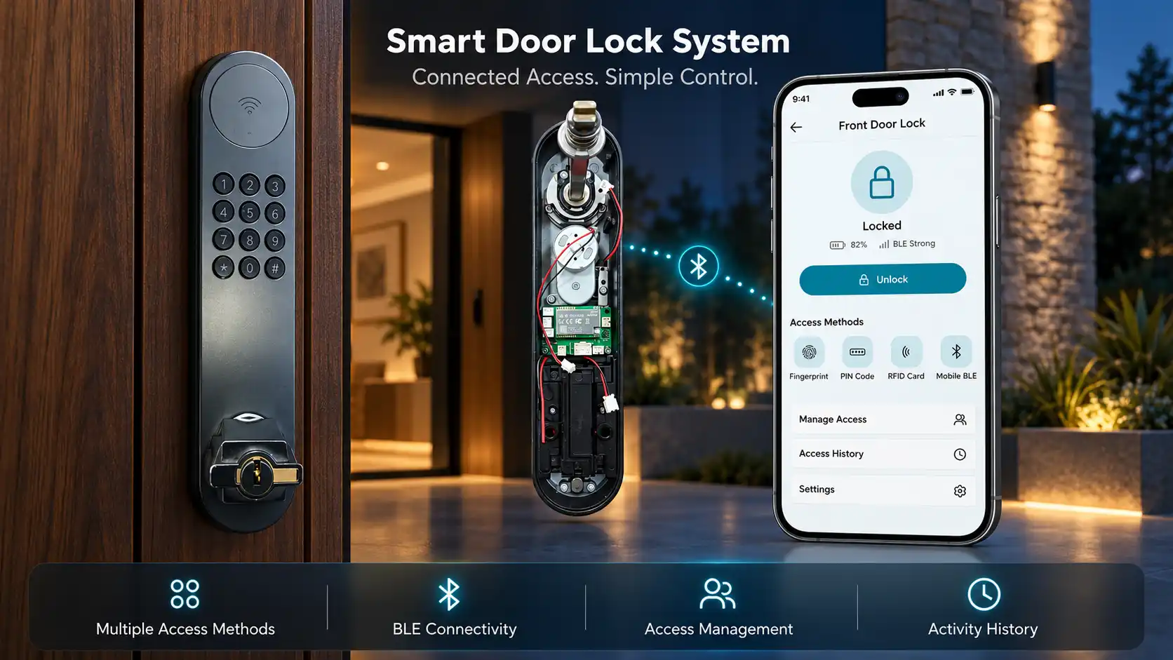
Smart Lock Hardware & Firmware Using nRF52840
Our Nordic nRF52 smart lock and access-control case study associated hardware, smartphone interactivity and cloud control. The ability to provide these integrations is important when location events are to be managed following a particular and defined operational procedure.
End-to-end Bluetooth RTLS development services
Tags and beacons
We design PCB and firmware around enclosure, attachment, battery life, advertising interval, and maintenance. Asset labels and wrist-worn devices have different constraints. An ordinary BLE advertisement by itself cannot provide CTE-based angles.
Integration of AOA locator and antenna
The design of a locator includes more than a Nordic development board. Our offering includes antenna count and layout, RF switching, feed routing, enclosure effects, mounting, power, backhaul, and on-site commissioning.
To minimize the risk of investment in custom antenna PCB, it is advisable to use an appropriate array or reference design at the very beginning.
The collection of raw I/Q data allows our team to differentiate between RF and positioning algorithms issues.
Positioning engine
The service converts observations into bearings and coordinates, combines readings from several anchors, filters unstable positions, and applies map constraints where appropriate.
It needs sensible behavior when one locator is blocked, an asset changes floors, or packets are missed. Confidence and last-seen timestamps belong in the API; silently drawing an old coordinate as a live position misleads operators.
Applications and integrations
We create visual representations of the floor layout and facilitate asset search, event location, device set-up, and access rights. Using APIs, all location data can be passed on to the maintenance systems.
Data retention and access settings refer to whether the system is able to track objects equipment-wise or people-person-wise.
Validation and implementation
Our test plan includes both stationary and mobile tags, crowded areas, anchor failures, battery life, and errors on the actual floor plan.
We give feedback about the pilot project and suggest changes to the device distribution before the design is expanded to other rooms or sites.
Where AoA and AoD create useful results
In a warehouse, AoA locators can help staff find returnable containers, shared tools, or mobile equipment. The first useful goal might be reliable zone identification rather than continuously drawing a dot on every shelf.
In a hospital, an equipment-finding application can reduce time spent hunting for pumps or wheelchairs, provided coverage, privacy rules, and cleaning workflows are addressed.
For factories, tagged carts or work-in-progress items can trigger arrival and departure events at stations. Here, false transitions may matter more than median position error.
AoD is the solution for wayfinding equipment that truly carries out the measurements from the receiving side, such as specialized handheld devices. Instead of presuming that all mobile phones use direction finding capabilities, we investigate the fleet of devices actually utilized by the users.
Outdoor GPS navigates by means of satellites, while indoor Bluetooth RTLS navigates via signal from transmitters. A hybrid solution may utilize GNSS for outdoor navigation and Bluetooth Low Energy for indoor navigation, but an indoor AoA setup does not turn into a worldwide device even if both systems provide location information.
How we scope and test your RTLS pilot
We first document the site's floor plans, asset types, expected movement, mounting restrictions, network access, and business events. The acceptance test defines a measurable outcome: for example, whether staff can reliably identify the correct room or find an item within a specified time.
We agree on update intervals, battery targets, and the acceptable fraction of missed or incorrect zone events before selecting hardware.
Next, a pilot captures observations at reference points and along realistic routes. We compare predictions with ground truth, inspect error by area, and repeat tests during normal operation.
If the RF environment makes the target unreliable, we change locator placement, adjust requirements, or consider another technology. After the pilot meets agreed criteria, we specify installation and maintenance procedures.
Frequently asked questions
AoA introduces directional information which can enhance positioning accuracy, but the results depend entirely on the antenna arrays, arrangement, calibration, and environment.
RSSI can be sufficient for general presence detection or room scale events, the pilot has to decide if angle measurement adds enough value to justify buying required hardware.
There is no universal number per square meter. Coverage, mounting geometry, obstructions, floors, and the required confidence determine the count. Multiple useful bearings improve position estimation, while poorly placed locators can produce more data without a better result.
Do not assume so. Nordic lists specific direction-finding-capable SoCs, including nRF52833 and nRF5340. We check the exact hardware and controller support; an existing beacon may need redesign.
Only if their phone has the right hardware, operating system, and application interface can they be used for measuring angle.
We check if devices can support AoA or suggest dedicated receivers before pursuing any directions with users.
The feasibility specification should include hardware shortlist, placement design, tagged use cases, assumptions about power consumption, functioning pilot, error and event measurement, rollout plan.
Please send us your house specification and the things that you would like to find out about, and we will help you create an RTLS proof of concept.
Editorial resources